This October has turned out to be very wet, which has hindered progress in this seasons field research. However between the rainy days this week, we were able to continue setting up the site grid and start several projects.
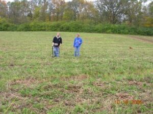
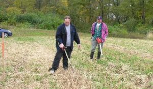 Picture 1 shows Joe Shaffer and Jim Bartlett conducting a metal detector survey. Before we start detecting a 20 meter by 20 meter survey block is laid out. Then on the north and south sides of the block guide stakes are placed 5 meters apart and twine is stretched between the stakes giving the operator a marked pathway for survey. Once there is a “hit” the metal detector makes a sound and the operator tries to pin point it’s location. The assistant then places a pin flag to mark the location. The operation continues on in this manner until the block is completed then the total number of pin flags are counted. Next the assistant takes a shovel and places it about 6 inches from the pin flag and pushes the shovel down and toward the pin flag removing about a 4 inch deep-shovel wide section of sod. This is scanned by the metal detector. If the object is in the sod section, the sod is divided in halves until the item is located. If the object is not in the sod the operator runs the metal detector over the hole and pin points the location again. More dirt is removed until the item is recovered. Once the artifact is found it is evaluated and if it is modern it is not kept. For example in the first block a pull tab, .22 caliber bullet, tin foil and a Wrigley’s Extra Spearmint gum wrapper were discarded. Next we bag the kept item, the hole is refilled, the pin flag is repositioned and the bagged artifact is placed by the pin flag. The team then moves to the next location until the block is completed. Afterward the grid location of each of the finds is recorded. Then it is on to the next block. We really hope the rains holds off for a while because we have about 80 more blocks to do!
 Picture 2 is of Dr. Jarrod Burks of Ohio Valley Archaeology(www.ovacltd.com) and Toni Gamble conducting an electrical resistance survey. In 2004 the same area was reviewed using magnetic gradient testing. Each test accumulates different but complimentary data and will be used to pinpoint areas for future investigation. This season three areas of interest will be examined consisting of over 60- 20 by 20 meter blocks.
Magnetic gradient testing measures small changes in the strength of the magnetic field across a site. Magnetic anomalies, which reflect changes in the magnetic properties of the soil and objects buried in the soil, can indicate the presence of buried walls or features such as hearths. Electrical resistance testing measures variations in the electrical resistance of soils. Changes in electrical resistance can be due to changes in soil moisture content or the structure and density of the sediment or materials buried beneath the surface. Electrical resistance anomalies can indicate the presence of buried pits, walls, or other features.
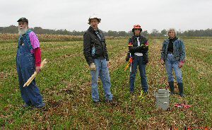 Picture 3 is of Bill Pickard, Brad Lepper, Veronica Frost and Martha Otto. Their job consisted of setting up the next course of 30- 20 by 20 meter blocks that will be surveyed with electrical resistance technology.
And finally picture 4 might give you some idea of the scale of the project. To the left is the metal detection crew, in the left circle is the grid crew, and in the right circle is the electrical gradient crew. Needless to say walkie talkies are a very valuable tool! 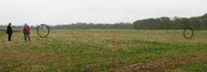
Until next time,
Linda