Ohio Artist Archibald Willard and the “Spirit of ’76”
Learn more about Archibald Willard, the Ohio artist who painted "Spirit of '76" to celebrate our nation's 100th birthday.
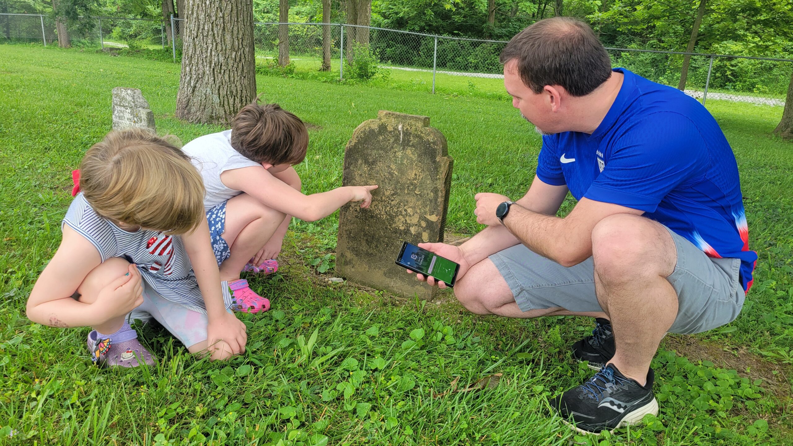
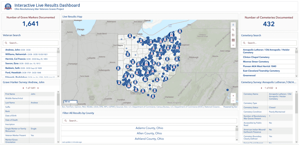
Ohioans now have a powerful, interactive way to connect with the Ohio Revolutionary War Veterans Graves Project through the Interactive Live Results Dashboard. Developed by the Ohio History Connection in partnership with America 250-Ohio, the dashboard is part of a sweeping, citizen-powered effort to document and preserve the final resting places of Revolutionary War veterans buried across Ohio.