Listen, Watch and Connect with LGBTQ+ History
Newly digitized audio and video recordings illuminate the history of HIV/AIDS in Ohio and impacts on the LGBTQ+ community.
 For a long time, at least in popular thought, the primary tool kit of an archaeologist consisted of a trowel, a small paint brush, a magnifying glass and a notebook. However over the past two or three decades especially the array of tools available for archaeological research has greatly expanded to include aerial and satellite photography and imaging, ground penetrating radar, magnetometers and soil conductivity and resistance metering . These all loosely fall into the category of remote sensing or the use of specialized research instruments that allow archaeologists to identify where areas of past human activity might be located without digging up half of creation looking for them. These instruments can find features as small as a fire pit or as large as a Hopewell earthwork in an Ohio woodlot or a long forgotten temple in a Mesoamerican jungle. The use of these instruments greatly reduces field time spent looking for a place to start and allow archaeologists to concentrate their efforts on more localized and productive areas.
One other method of remote sensing that has come in from the cold in just the past few years to be recognized as an important research tool is the applied use of metal detecting. While not having a great deal of utility on pre-contact sites they have become almost standard equipment in research at historic era or post-contact sites. Metal detectors were use several years ago at the Little Bighorn Battlefield to discover both the scope and the order of battle during Custers infamous last stand. In the 1990s similar methods were used to discover the true location of the Fallen Timbers battlefield near Toledo which ended up being in a much different location than had been believed for nearly 200 years.
At Pickawillany metal detectors have allowed archaeologists to concentrate their research efforts on what appears to be the most significant portion of a nearly 40 acre field. Ball State University has a comprehensive metal detector survey of several dozen acres in the fields surrounding Fort Recovery and the site of St Clairs defeat planned for later this year to hopefully expand what can be discovered about the monumental events that took place at that location. This does not mean that a site can be investigated indiscriminately and come up with results something like there seems to be a bunch of stuff over by the oak tree, not the big oak tree but the other one or is it the first one, oh well lets go look for more. To use such instruments properly or to do archaeology properly in general, a grid of the area to be investigated first needs to be established and the exact location of each object recovered or feature discovered plotted on that grid. Only then will a true assessment of the character and layout of the site be established and order derived from what appears to be chaos; anything less amounts to a goody-grab.
Basically speaking, metal detectors consist of a pair of electrical coils that operate on alternating current. When the first coil comes in close proximity to a piece of electrically conductive material (metal) it induces a current into that object and creates a somewhat distorted magnetic field around the object that is in turn detected by the second coil. Besides archaeological applications, metal detectors are typically used by hobbyists looking for coins and other forms of buried treasure and by prospectors looking for metallic ores. Construction personnel use them to look for wiring and steel reinforcing rods inside walls and to locate property boundary markers. Forms of metal detecting instruments are also used for security purposes at prisons, airports and government buildings. They are literally just about everywhere anymore. The first patent for a metal detecting device was granted to Gerhard Fisher in 1925. Fishers design was later refined by Polish Army Lieutenant Josefz Kosacki and widely used by the Allies in WWII to detect and clear German minefields. Refined versions of Kosackis machine continue to serve the same purpose in war zones throughout the world into the present time. Since WWII metal detecting devices have become highly sophisticated instruments with innovations and improvements contributed by folks named White and Garrett. Their refinements have produced instruments considered to be flagships of the industry in their own right and tout features that Fisher or Kosacki probably never dreamed possible. As far as can be told the first use of metal detectors in an archaeological context was actually done using a device designed by Shirl Herr of Indiana. In a strange turn of events, Herr actually attempted to register his Hidden-Metal Detector with the U.S. Patent Office several months before Fisher first applied but for whatever reason Herr was not granted a patent until 1928, thus allowing Fisher to claim proprietorship as the inventor or at least the holder of the first patent. Undeterred by this slight Herr used his detector to locate an old fort near West Lafayette, Indiana as well as a campsite in Pennsylvania used by General Braddocks men to destroy weapons in order to keep them out of French hands following Braddocks 1754 defeat on the Monongahela.
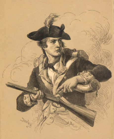
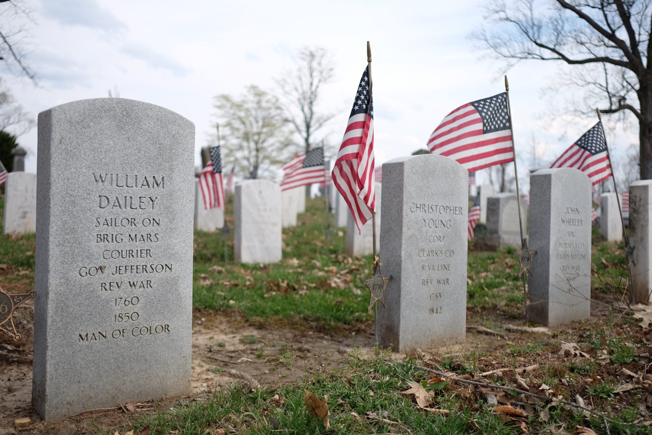
In 1929 Herr and his machine were employed by Benito Mussolini in the dictators efforts to locate and recover one of Emperor Caligulas galleys from Lake Nemi in Italy.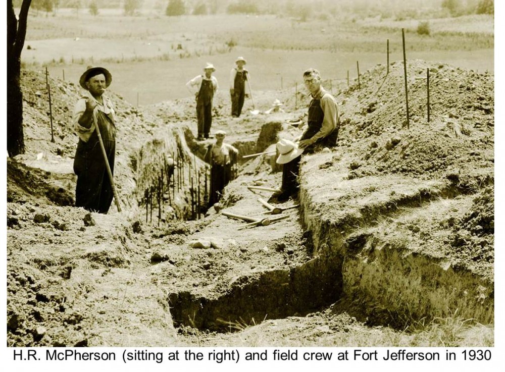 In 1930 and much closer to home than Lake Nemi, Harry R. McPherson, Business Agent of the Ohio Archaeological and Historical Society (now OHS) was directing his efforts to find the remains of Fort Jefferson, located along the western edge of Ohio, south of Greenville. It was McPhersons hope to use his work as the basis for reconstructing the fort as a then unique tourist attraction. As a matter of background, Fort Jefferson was built in October 1791 by General Arthur St Clair during his campaign into the Northwest to chastise the tribes of the Ohio Country. It was situated on a low glacial knoll at the edge of a large pocket prairie and the fourth in a chain of forts extending north from present day Cincinnati built as military support and supply locations. Within two weeks of marching northward out of Fort Jefferson, St. Clair and his army was dealt a resounding defeat by a superior allied Native American force led by the Miami Chief Little Turtle near the headwaters of the Wabash River at Fort Recovery, Ohio. It was a complete disaster and a total rout of the American army, in fact it was the worst defeat ever suffered by an American army and those remnants that managed to survive fled back to the relative safety of Fort Jefferson by any means possible. Many made the 30 mile or so trek on foot through the mud and the snow without shoes, having cast them aside because they were too cumbersome to run in. Fort Jefferson was used again a year or so later by General Mad Anthony Wayne as a supply depot during in his renewed campaign through western Ohio that ended with his final victory in the Battle of Fallen Timbers. The fort also later served as a safe haven for settlers in the area until it was finally abandoned and burned by soldiers of the garrison under orders from Army Command in 1796.
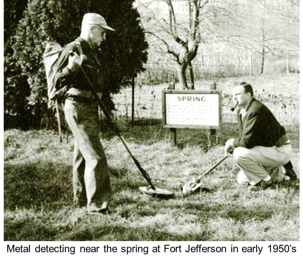
In 1930 McPherson did not have the luxury of remote sensing of any sort in his investigations at Fort Jefferson, not even a plan drawing of what to expect, only vague descriptions of what might be expected or encountered. While not operating by truly modern standards he approached it in an orderly, rational and systematic manner and discovered the locations of several structures and sub-surface features and passage ways and recovered a wide variety of fort related artifacts. More importantly he recorded what he found and had a professional surveyor draft a map of his investigations when he was finished. He was apparently very proud of his efforts and quite frankly rightfully so. In a 1930 edition of Museum Echoes (an OAHS/OHS publication serving its membership) McPherson noted that This was the second time within the history of Ohio and one of the few times in the country that modern archaeological tactics were employed in locating historical sites. The first effort was the location of the Village of Schoenbrunn at New Philadelphia McPhersons work was buttressed some years later in a post-WWII survey of the site using a converted war surplus mine detector as a more general purpose metal detector. The exact results of this second survey are unclear, but you do have to wonder how much better the data returns of McPhersons project would have been if such remote sensing technology had been available to him back in 1930, even if it was rather primitive in form.
Bill Pickard