The Digital Scholarship Lab of the University of Richmond has produced a digital version of Charles O. Paullin and John K. Wright’s 1932 Atlas of Historical Geography of the United States. It’s a wonderful resource including nearly 700 maps, which the Digital Scholarship Lab has “enhanced in ways impossible in print, animated to show change over time or made clickable to view the underlying data.” The Atlas includes a section on American Indians, which is useful, but in an associated blog post, Robert Nelson addresses important biases in the treatment of American Indians in this classic work: “In the introduction they characterized North America as ‘a boundless domain [which] until recently lay open for governments, companies, and individuals to seize and subdivide and use.’ Native Americans only had, they suggested, ‘shadowy claims’ to this domain, ‘which in the long run were easily swept aside.’ Maps can be remarkably powerful tools for shaping perceptions of the way the world looks and works.”
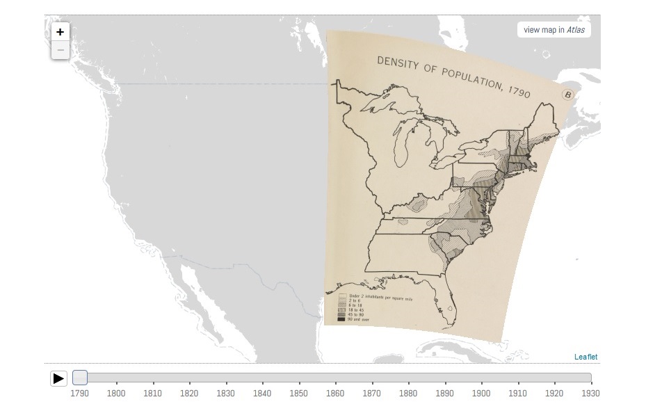
One example of the maps in the Atlas of the Historical Geography of the United States showing the population density of European-Americans in 1790 with no reference at all to American Indians.